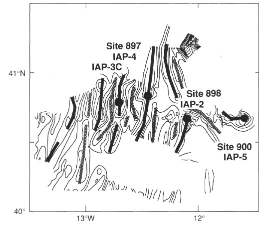
Figure 5. Preliminary basement contour map (0.25 s two-way traveltime contour interval) based on unmigrated multichannel and single-channel seismic reflection profiles with the highs and lows highlighted by black and gray lines, respectively. Numbers and dots indicate sites planned to be drilled during Leg 149.
![]()