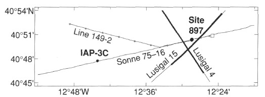
Figure 4. Multichannel seismic reflection and site-approach-survey (Line 149-2) track chart. Bold lines indicate the parts of Lusigal Lines 4 and 15 shown in Figure 5 and Figure 6. The location of the seafloor fault identified in echo-sounder data (Fig. 7) is indicated with an open square.