![]()
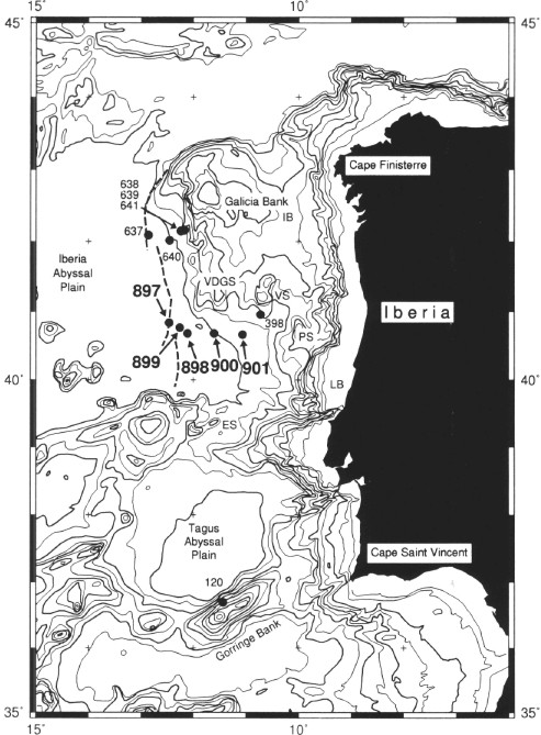
Figure 1. Location map for Sites 897 through 901 drilled on Leg 149, modified from Whitmarsh et al. (1994). Bathymetry is in meters, with bold contours at 1000-m intervals. The other numbered sites were drilled on Legs 13, 47B, and 103. The dashed lines near Sites 637 and 897 mark the predicted positions of peridotite ridges. Location abbreviations are as follows: ES = Estremadura Spur; LB = Lusitanian Basin; PS = Porto Seamount; VS = Vigo Seamount; VDGS = Vasco da Gama Seamount; IB = Galicia Interior Basin.
![]()