![]()
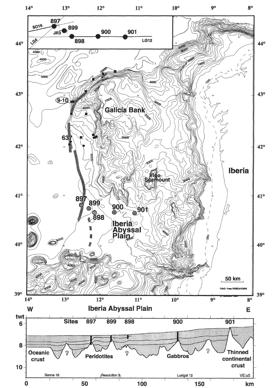
Figure 1. Bathymetric map of western Iberia Margin (Lallemand et al., 1985) and schematic cross-section through the Iberia Abyssal Plain showing the location of sites drilled during Leg 149. Former drill sites (Leg 103: small black dots), and dive sites (Galinaute cruise: black squares, including dive sites 9-10), on the Galicia Margin are also located. The gray dashed line indicates the peridotite ridge.
![]()