![]()
Table 1. Depth (mbsf) two-way traveltime (ms) beneath seafloor and possible correlations between seismostratigraphic Units 1-3 and depth in biostratigraphy of Leg 149 sites.
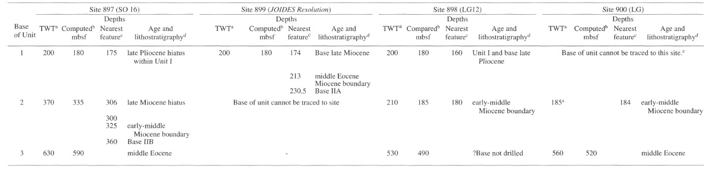
a Depth of the base of the unit in two-way traveltime measured at the site.
b Depth computed from measurements on seismic profiles using the sonobuoy data of Whitmarsh et al. (1990).
c Where the computed depth does not coincide exactly with a significant stratigraphic boundary or hiatus, the depths of nearby features identified from drilling results are shown (see footnote d).
d Age of sediment (from de Kaenel and Villa, this volume) at depths shown is given, or nearest stratigraphically significant feature (see footnote c), plus relationship to lithostratigraphic units defined in the Leg 149 Initial Reports (Shipboard Scientific Party, 1994a-c).
e The base of seismic Unit 1 cannot be traced into the Site 900 area because the base of Unit 2 pinches out adjacent to Site 898
(Fig. 5C). Therefore the depth of the base of the combined Units 1 and 2 is shown at a depth of 185 m.
![]()