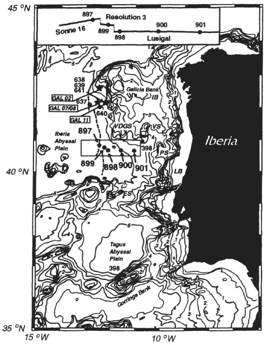
Figure 2. Bathymetry (500-m contour interval with thick annotated lines every 1000 m) of the West Iberian Margin and location of Leg 149 Sites 897-901. Also shown are drill sites from ODP Leg 103 (637-641); labels in boxes denote location of dredged rock samples used for measurement of radiogenic heat production. The bold dashed line is the predicted location of the peridotite ridge (Beslier et al., 1993). The inset map (top) shows the location of seismic profiles (solid lines) used to construct the composite structural section in Figure 3. IB = Galicia Interior Basin, VDGS = Vasco da Gama Seamount, VS = Vigo Seamount, PS = Porto Seamount, LB = Lusitanian Basin, ES = Estremadura Spur. After Shipboard Scientific Party (1993).