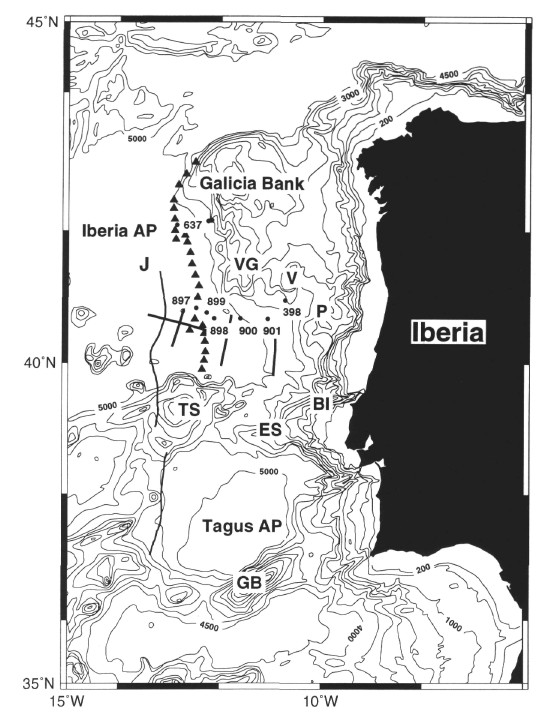
Figure 2. Bathymetric chart of west Iberia (contour interval 200, 500, 1000, 1500, etc., m). Triangles denote the position of the peridotite ridge (from Beslier et al., 1993); solid circles are positions of DSDP/ODP sites; open circle is position of undrilled Site IAP-3C; bold line is the magnetic J anomaly picked from the reduced-to-the-pole chart of Miles et al., (this volume, Fig. 1). VG = Vasco da Gama Seamount, V = Vigo Seamount, P = Porto Seamount, TS = Tore Seamount, ES = Estremadura Spur, BI = Berlenga Islands, GB = Gorringe Bank.