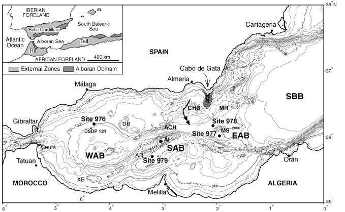
Figure 1. Bathymetric map of the Alboran Sea showing the location of Leg 161 sites and the proposed source area for the carbonate debris-flow bed. Note the location of the Holocene temperate-carbonate platform (black squares) and the fringing talus (stippled) at the offshore prolongation of Cabo de Gata. The two-arrowed line marks the path of the Andarax Canyon turbidite system. Bathymetric contour lines are every 200 m. ACH = Alboran Channel, AI = Alboran Island, AR = Alboran Ridge, CHB = Chella Bank, DB = Djibouti Bank, EAB = Eastern Alboran Basin, MR = Maimonides Ridge, MS = Al-Mansour Seamount, SAB = South Alboran Basin, SBB = South Balearic Basin, WAB = West Alboran Basin, and XB = Xauen Bank. The inset map shows the location of the Alboran Sea between the Betic and Rif Cordilleras, and general tectonic subdivisions.