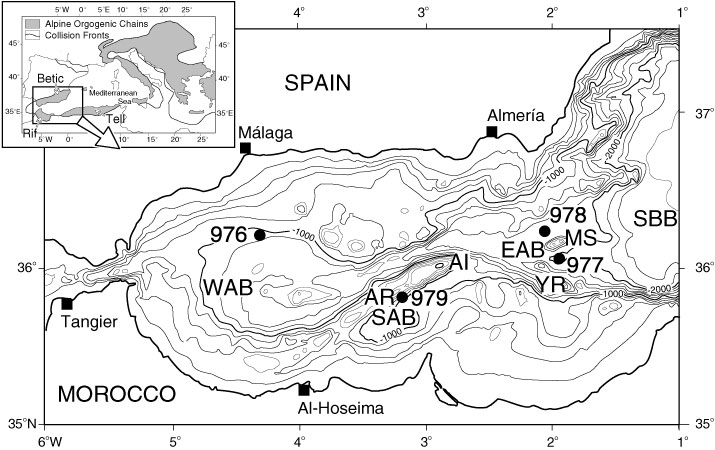
Figure 1. Bathymetric map of the Alboran Sea showing Leg 161 Sites 976, 977, 978, and 979, the location of major basement features, and surrounding clastic source terrains (Rif, Betic, and Tell Cordilleras). Contours in meters, contour interval is 200 m. AI = Alboran Island, AR = Alboran Ridge, EAB = East Alboran Basin, MS = Al-Mansour Seamount, SAB = South Alboran Basin, SBB = South Balearic Basin, WAB = Western Alboran Basin, YR = Yusuf Ridge.