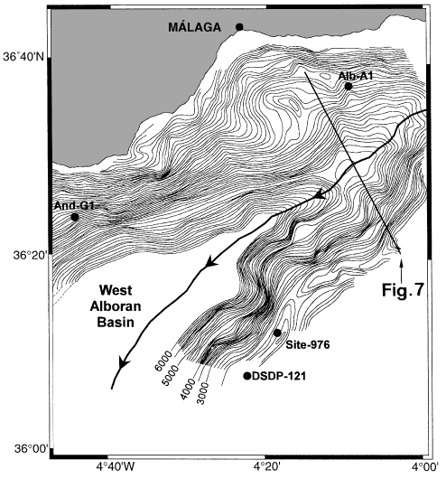
Figure 8. Contour map of basement depth in the northeastern branch of the Western Alboran Basin. Contour lines are every 100 ms (TWT). Note the complex fault-related morphology at the northwestern slope of the basement high on which Site 976 is located. Straight line shows the position of the multichannel seismic line in Figure 7. Alb-A1 and And-G1 = commercial boreholes. Bold line with arrows marks the northeastern end of the early Miocene main depocenter in the Western Alboran Basin; the whole path of this sedimentary depocenter is depicted in Figure 2.
![]()