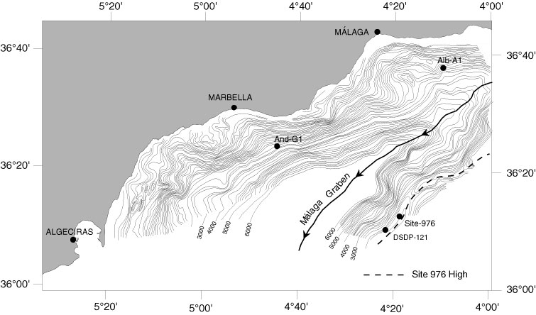
Figure 10. Basement depth contour map of the Málaga Graben (de la Linde et al., 1996). Contour lines every 100 ms (TWT), showing Andalucía-G1 (And-G1), Alborán-A1 (Alb-A1), DSDP 121, and Site 976 locations. Both flanks of the graben correspond to complex interference of former submarine or formerly emerged surfaces and low- and high-angle normal faults, normal-oblique transfer faults, and tops of rollover structures affecting the basement. Steep surfaces near the Spanish coast correspond to post-Messinian strike-slip or oblique faults that prolongate on land.