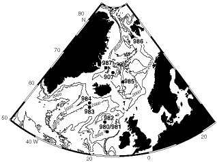
Figure 1. Location map of sites drilled during Leg 162 in the subpolar North Atlantic and Nordic Seas. Contour interval is 1000 m.