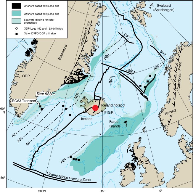
Figure F1. Geologic map of the North Atlantic showing main physiographic features of the region, selected Deep Sea Drilling Project (DSDP) and Ocean Drilling Program (ODP) drill sites, distribution of seaward dipping reflector sequences, outcroppings of Tertiary flood basalts, and locations of main seafloor spreading anomalies. GFZ = Greenland Fracture Zone, SFZ = Senja Fracture Zone, JMR = Jan Mayen Ridge, IGR = Iceland-Greenland Ridge, FIGR = Faeroe-Iceland-Greenland Rise.