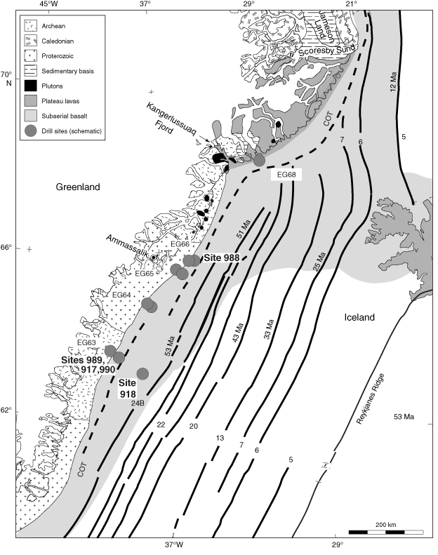
Figure F1. Summary map of the south East Greenland continental basement and continent–ocean transition, plateau lavas, plutons, Jameson Land sedimentary basis, and subaerial seaward dipping reflectors. Thick lines = seafloor spreading magnetic anomalies identified by Chron and age. COT = continent–ocean transition.