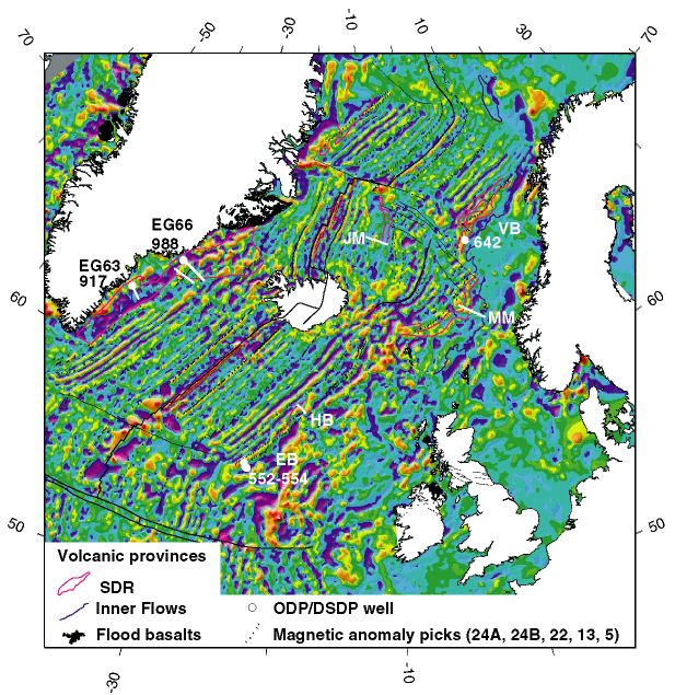
Figure
1. Magnetic anomaly map of the northeast Atlantic,
showing main structural and magmatic features, selected
drill sites penetrating breakup volcanics, and location of
seismic profiles. Shown are DSDP Sites 552-554 (Roberts,
Schnitker, et al., 1984), ODP Site 642 (Eldholm, Thiede,
Taylor, et al., 1987), and Transects EG63 and EG66
(Larsen, Saunders, Clift, et al., 1994; Duncan, Larsen,
Allan, et al., 1996). EB = Edoras Bank, HB = Hatton Bank
Margin, JM = Jan Mayen Ridge, MM = Møre Margin, VB =
Vøring Basin. Magnetic data from Verhoef et al. (1996).