![]()
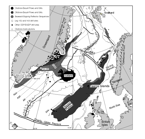
Figure 1. Map showing the distribution of seaward-dipping reflector sequences, onshore flood basalts, layered gabbro intrusions, and oceanic drill sites in the northeast Atlantic. The age of the oceanic crust is portrayed by its seafloor magnetic anomalies (e.g., A24). Also shown is the Caledonian front. FIGR = Faeroe-Iceland-Greenland ridge (hot spot track); JMFZ = Jan Mayen Fracture Zone. Modified after Larsen and Saunders (1998).
![]()