![]()
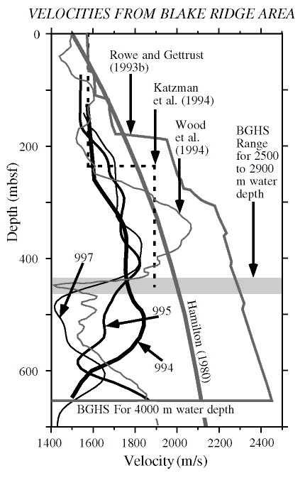
Figure 2. Velocities from VSPs are compared to a global average for terrigenous sediments (Hamilton, 1980) and to velocities derived from wide-angle OBH data (Katzman et al., 1994) from a 6-km, surface-towed streamer (Wood et al., 1994) and from deep-towed MCS data (Rowe and Gettrust, 1993b). The data used by Wood et al. (1994) were acquired 90 km to the west in water 2660 m deep, and data used by Rowe and Gettrust (1993b) were acquired 160 km to the south in water 4000 m deep. For sediments in the few hundred meters above the BSR, the lowest velocities are found on the ridge crest and the highest off the southern flank.
![]()