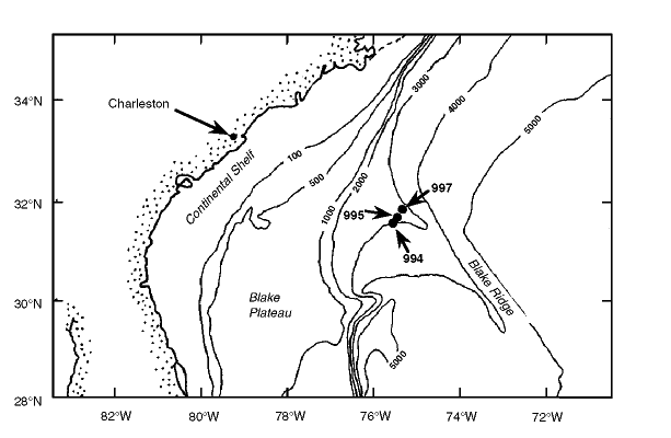
Figure 1. Map location for Leg 164 drilling, including the location of Site 997. The contour shows the bathymetry in meters below sea level.