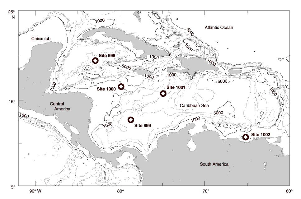
Figure 1. Location map of sites drilled during Leg 165. Of the sites discussed here, Site 998 is located on the Cayman Rise (19°29.377´N, 82°56.166´W, 3179.9 m water depth) and is flanked to the north by Yucatan Basin and to the south by the Cayman Ridge and Cayman Trough. Site 999 is located in the Colombian Basin, on what is now named the Kogi Rise (12°44.639´N, 78°44.360´W, 2827.9 m water depth), ~150 km northeast of the Mona Rise. Site 1001 is in the lower Nicaraguan Rise on the Hess Escarpment (15°45.427´N, 74°54.627´W, 3259.6 m water depth) (from Sigurdsson, Leckie, Acton, et al., 1997). Sites 925 and 929 are located off the map to the east in the Amazon River Basin.
![]()