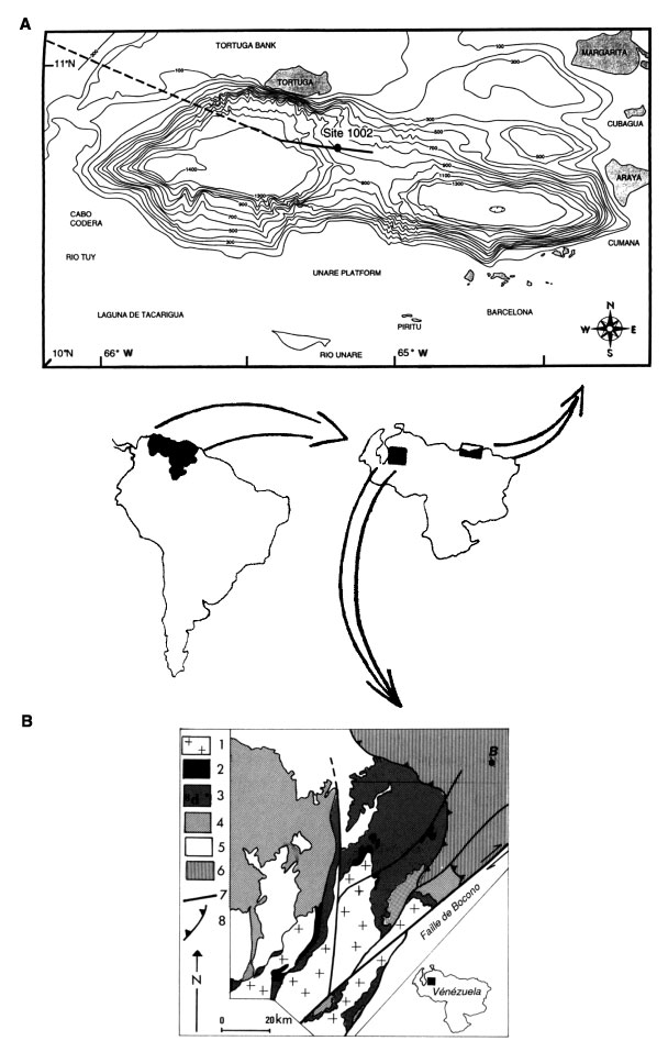
Figure 1. The Venezuelan areas included in this study. A. Cariaco Basin with bathymetric curves. Dashed line = trackline of the JOIDES Resolution. B. The Transversale de Barquisimeto (Aubouin, 1975) shown by a simplified geological map: B = Barquisimeto; 1 = crystalline outcrops, 2 = Jurassic, 3 = Cretaceous, 4 = Cenozoic, 5 = post-thrusting deposits, 6 = allochthonous formations, 7 = major faults, and 8 = thrusts.
![]()