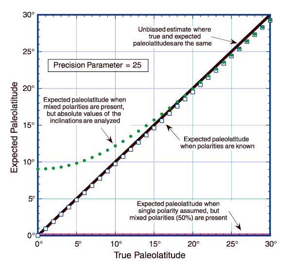
Figure 7. Paleolatitude biases occur when inclination data are analyzed in different ways to get a mean paleolatitude. The diagonal line (thick solid line running from lower left to upper right) represents the desired case, where mean paleolatitude = true paleolatitude. If the geomagnetic polarity of all units sampled is known, the mean paleolatitude is virtually identical to the true paleolatitude for low paleolatitudes (squares). A very large error can occur, however, when the geomagnetic polarity is assumed (gray line running along the bottom of the plot), and in this example the assumption is wrong 50% of the time. Simply analyzing the paleolatitudes computed from the absolute values of the inclinations, however, gives an expected mean paleolatitude that does not depend on assumptions about the polarity (dotted line). These too are biased, but the size of the bias can be estimated (expected values) and then corrected. We use such expected values to correct the mean paleolatitudes presented in this paper. All calculations shown are for the case when the precision parameter (k) is 25.
![]()