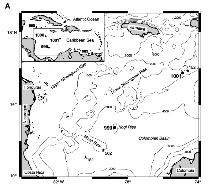
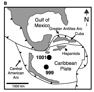
Figure 1. A. ODP Sites 999 and 1001 (solid circles) and nearby DSDP sites (stars). Boxed insert shows location of all sites drilled during Leg 165 in the Caribbean Sea. Contours are in meters below sea level (GMT map, Wessel and Smith, 1995). B. The Paleocene Caribbean (tectonic reconstruction from Pindell and Barrett, 1990) and location of Sites 999 and 1001.
![]()