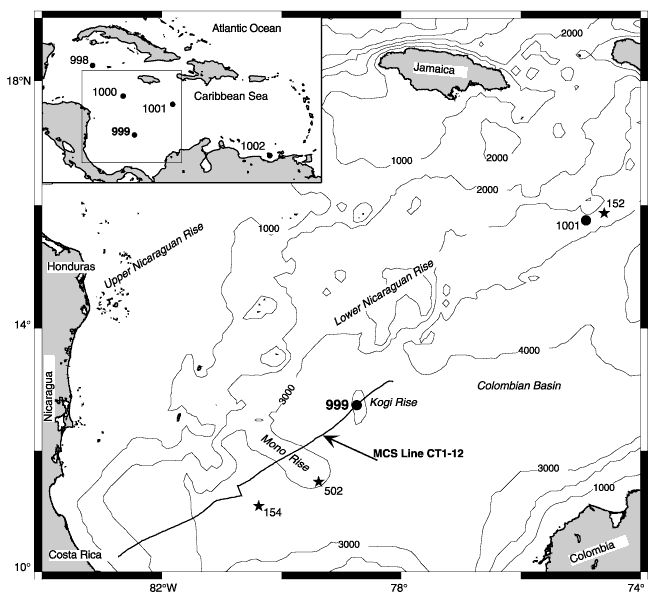
Figure 1. Bathymetric map (1000-m contour interval from ETOPO-5) showing the location of Site 999 on the Kogi Rise and the surrounding physiographic features of the western portion of the Caribbean Sea. Coverage of MCS Line CT1-12 is shown as thick solid line and Deep Sea Drilling Project sites are located with solid stars. Boxed insert shows location of all sites drilled during Leg 165 in the Caribbean Sea (GMT map, Wessel and Smith, 1995).
![]()