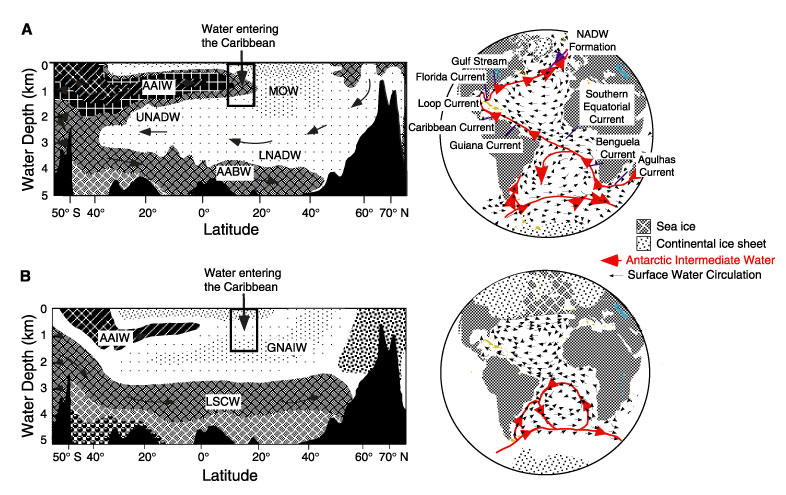
Figure 6. A. Circulation of water masses along a north-south profile of the modern Atlantic Ocean. Atlantic surface and Antarctic Intermediate Water circulation are also shown on a map view (Gordon, 1986; modified by Haddad and Droxler, 1996). AABW = Antarctic Bottom Water; AAIW = Antarctic Intermediate Water; LNADW = lower North Atlantic Deep Water; UNADW = upper North Atlantic Deep Water; MOW = Mediterranean Outflow Water. B. Postulated circulation of water masses along a north-south profile of the Atlantic Ocean during the last glacial maximum (LGM). Inferred surface and intermediate water circulation during the LGM are also shown on a map view. GNAIW = glacial North Atlantic Intermediate Water. Figures also schematically show the water at latitudes and depths to enter the Caribbean over sills in the Antilles. From Haddad and Droxler (1996).
![]()