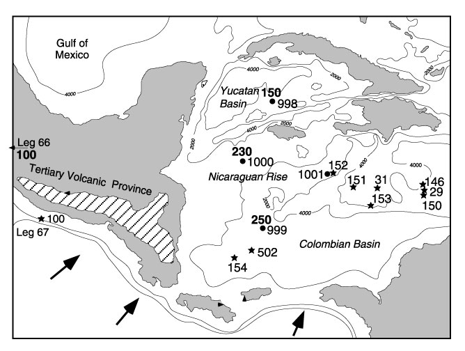
Figure 7. The relationship between Miocene Central American ignimbrite volcanism (Tertiary volcanic province) and the Miocene tephra fallout record observed in Caribbean sediments drilled during Leg 165. Numbers at solid circles indicate site locations; boldface numbers refer to the Miocene peak ash layer accumulation rate (in centimeters per million years). Stars indicate location of DSDP sites. The map represents a paleogeographic reconstruction based on inferred transcurrent motion of the Cayman Trench since the Miocene (Sigurdsson, Leckie, Acton, et al., 1997).
![]()