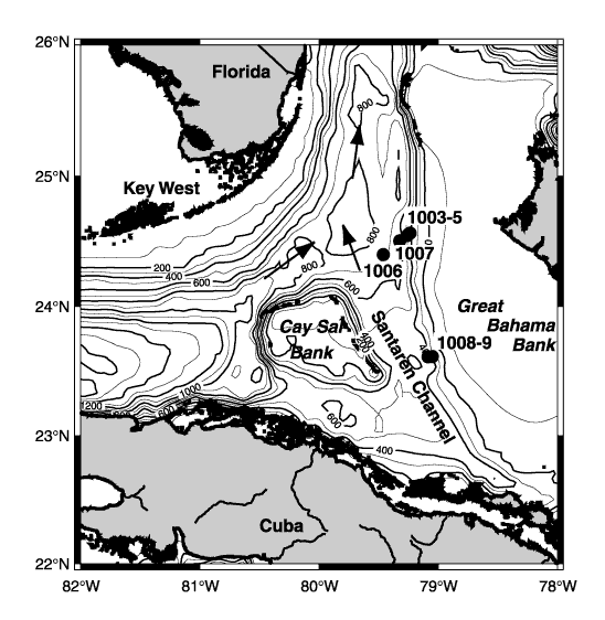
Figure 1. Bathymetric map of the Straits of Florida. The locations of the drill sites (numbered) are indicated by solid circles. Also shown are flow directions of the currents.