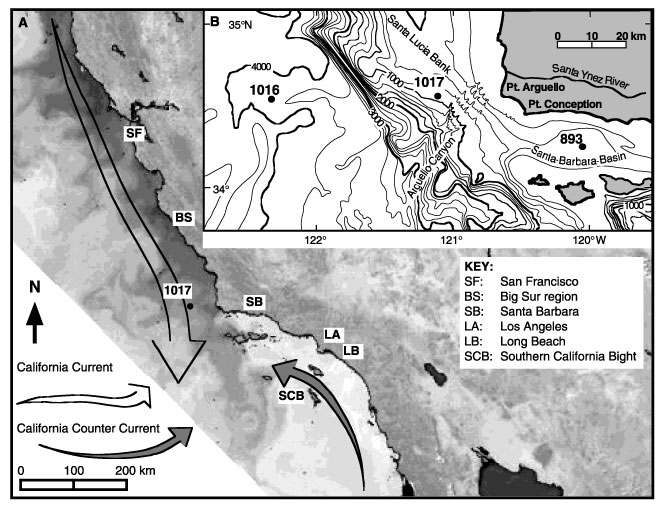
Figure 1. Location map. A. Annotated coastal zone color scanner image of currents along the California margin showing the location of Site 1017 and geographical reference points. B. Inset map showing ODP Sites 1016, 1017, and 893; bathymetry of region; and locations of the Santa Ynez River, Santa Lucia Bank, Arguello Submarine Canyon and feeder canyons, and Santa Barbara Basin.
![]()