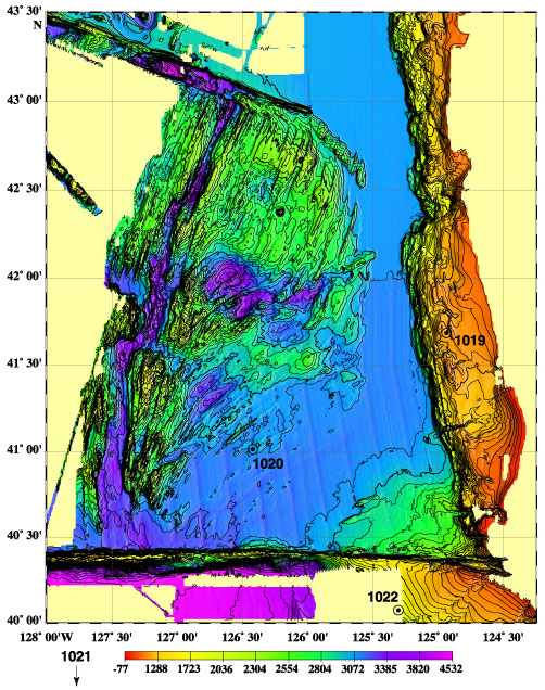
Figure 20. Locations of Sites 1019 and 1020. The base map was produced by the NOAA VENTS program in August 1998. Site 1019 (41°41´N, 124°56W) is located in the actively deforming edge of the Eel River Basin, due west of Crescent City, California, at a water depth of 980 mbsl.
![]()