![]()
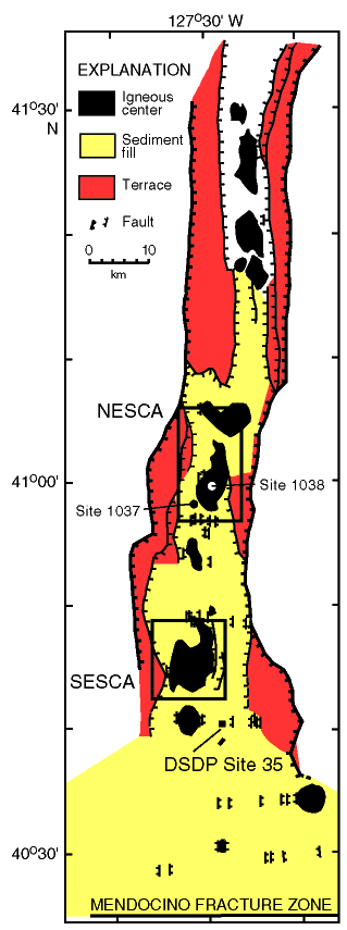
Figure F5. Map of Escanaba Trough in the southern portion of the Gorda Ridge spreading center showing the sediment-filled portion of the trough, intratrough terraces, and the volcanic centers that rise through and locally pierce the sediment cover. The location of Sites 1037 (reference hole) and 1038 drilled during Leg 169 are shown. NESCA = northern Escanaba Trough study area and SESCA = southern Escanaba Trough study area. Modified from Morton et al., 1994.
![]()