![]()
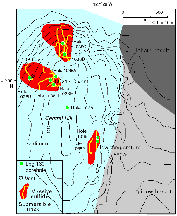
Figure F6. Detailed map of Central Hill showing the position of holes drilled at Site 1038 during Leg 169. Location of active vents and exposed volcanic rock are based on camera tows and submersible tracks shown as thin lines. Modified from Zierenberg et al., 1994.
![]()