![]()
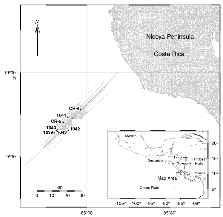
Figure F1. Map of the Costa Rica Margin showing the location of Sites 1039-1043 in relationship to the 2-D and 3-D seismic reflection surveys carried out offshore of the Nicoya Peninsula. Proposed Sites CR-4 and CR-5 are shown for reference purposes. Two-dimensional lines are shown as lines. Three-dimensional data set is within the shaded rectangular area.
![]()