![]()
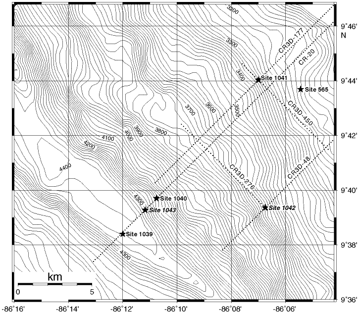
Figure F4. Bathymetric map of the Leg 170 study area showing the depths and locations of the five Leg 170 sites. Included are seismic reflection survey lines CR-20, on which Sites 1039, 1040, and 1043 are located, lines CR3D-48 and CR3D-450, on which Site 1042 is located, and lines CR3D117 and CR3D-450, on which Site 1041 is located. The bathymetric contour interval is 20 m.
![]()