![]()
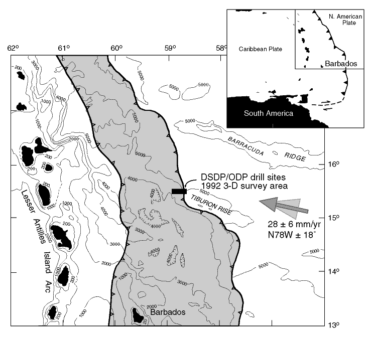
Figure F1. Location map of the Leg 171A area, previous DSDP/ODP legs, and 3-D seismic survey (black box). Shaded area represents Barbados accretionary prism. The accretionary prism is divided into northern and southern parts at about 15°N, where the Tiburon Rise impinges on the prism. Arrow indicates direction of convergence of the North American plate relative to the Caribbean plate (28 ± 6 mm/yr along N78W ± 18°) (Dixon et al., 1998). Depths are in meters.
![]()