![]()
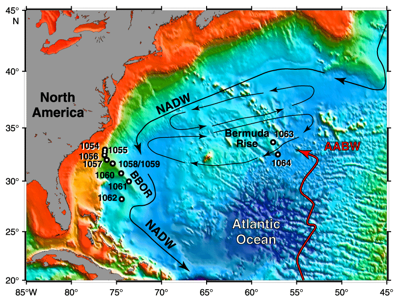
Figure F1. Map of the western North Atlantic showing the Leg 172 site locations on the Carolina Slope (Sites 1054 and 1055), the Blake-Bahama Outer Ridge (BBOR) (Sites 1056-1062), the northeast Bermuda Rise (Site 1063), and the Sohm Abyssal Plain (Site 1064). Imposed on top of this are schematic circulation patterns, including the North Atlantic Deep Water (NADW) (thick black lines), Antarctic Bottom Water (AABW) (thick shaded line), and gyre currents (thin black lines).
![]()