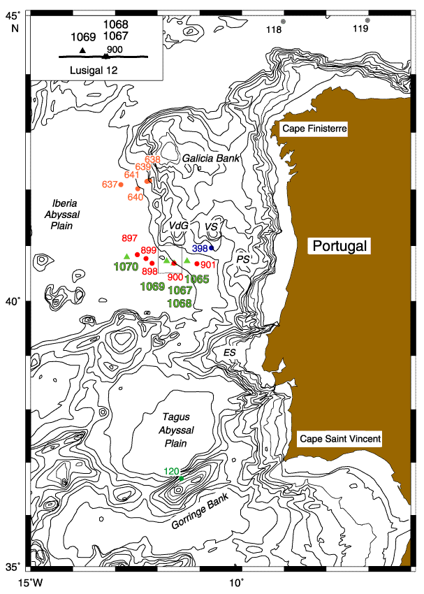
Figure F1. Location map showing ODP Sites 1067, 1068, 1069, and 900 and DSDP Site 398. Triangles = Leg 173 sites, circles = sites from previous legs. Bathymetry contours are at 200, 500, 1000, and 1500 through 5500 m. VdG = Vasco da Gama Seamount, VS = Vigo Seamount, PS = Porto Seamount, ES = Estremadura Seamount. Inset shows drill site locations relative to the seismic reflection profile used to create the composite section in Figure F2 (adapted from Whitmarsh, Beslier, Wallace, et al., 1998, p. 9).
![]()