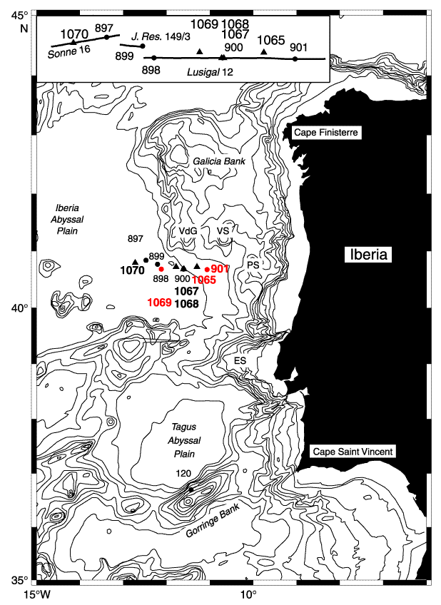
Figure F1. Bathymetric chart of the west Iberia margin (contours at 200, 500, 1000, 1500 through 5500 m). Leg 149 sites are shown by solid circles. Sites drilled during Leg 173 are shown by solid triangles. Sites with Jurassic clastic sediments are in red. VdG = Vasco da Gama Seamount, VS = Vigo Seamount, PS = Porto Seamount, ES = Estremadura Spur. Inset shows locations of drill sites relative to three seismic reflection profiles used to create the composite section in Figure F2 (after Shipboard Scientific Party, 1998a, fig. 1).
![]()