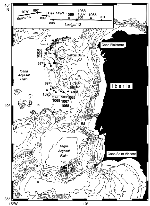
Figure F1. Contoured bathymetric map of the west Iberia margin with contours at 200, 500, 1000, and 1500-5500 m. Triangles = sites drilled during Leg 173; Sites 1067 and 1068 are referred to in this report. Solid circles = existing Deep Sea Drilling Project/Ocean Drilling Program (ODP) sites; Sites 899 and 900 from ODP Leg 149 are referred to in this report. Solid squares = submersible dive sites, open diamonds = peridotite ridge, crosses = dredge sites. VS = Vigo Seamount, VdG = Vasco da Gama Seamount, ES = Estramadura Spur. From Whitmarsh, Beslier, Wallace, et al. (1998).
![]()