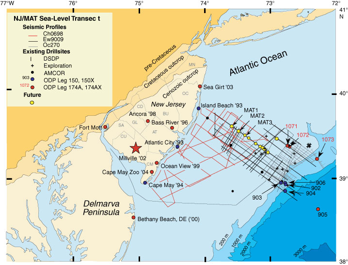
Figure F1. Location map showing existing ODP boreholes analyzed as a part of the New Jersey (NJ)/Mid Atlantic (MAT) sea level transect. Also shown are multichannel seismic data (MCS) from Ewing Cruise 9009 (Ew9009), Oceanus Cruise (Oc270), and Cape Hatteras cruise (CH0698). Millville borehole location is shown as a star. MN = Monmouth County, OC = Ocean County, BU = Burlington County, CD = Camden County, GL = Gloucester County, AT = Atlantic County, SA= Salem County, CU = Cumberland County, CM = Cape May County. AMCOR = Atlantic Margin Coring Project.