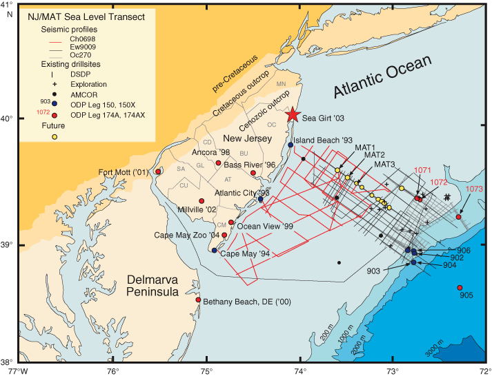
Figure F1. Existing Ocean Drilling Program (ODP), Deep Sea Drilling Project (DSDP), and Atlantic Margin Coring Project (AMCOR) coreholes analyzed as a part of the New Jersey/Mid-Atlantic (MAT) sea level transect. Also shown are multichannel seismic data (MCS) from Ewing (Ew9009), Oceanus (Oc270), and Cape Hatteras (CH0698) cruises. Star = Sea Girt corehole, MN = Monmouth County, OC = Ocean County, BU = Burlington County, CD = Camden County, GL = Gloucester County, AT = Atlantic County, SA = Salem County, CU = Cumberland County, CM = Cape May County.