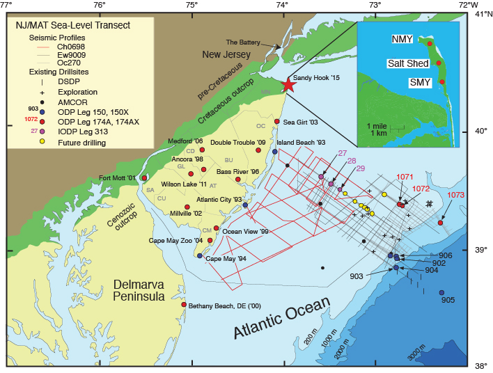
Figure F1. Location map showing existing ODP boreholes analyzed as a part of the New Jersey/Mid Atlantic (MAT) Sea-Level Transect. Also shown are multichannel seismic data (MCS) from Ewing Cruise 9009 (Ew9009), Oceanus Cruise (Oc270), and Cape Hatteras cruise (Ch0698). NJGS = New Jersey Geological Survey, USGS = U.S. Geological Survey, AMCOR = Atlantic Margin Coring Project.