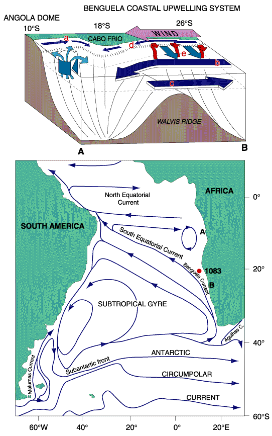
Figure F1. Location of Site 1083, Leg 175 (20°53´S, 11°13´E; water depth = 2178 m; penetration = 201.3 mbsf). Major water masses over the site are shown in both aerial and schematic view along transect AB (modified from Berger et al., 1998; Dowsett and Willard, 1996; Hay and Brock, 1992), where a = Angola Current, b = Benguela Oceanic Current, c = poleward-flowing undercurrent, d = Benguela Coastal Current, and e = divergence and upwelling over shelf break.
![]()