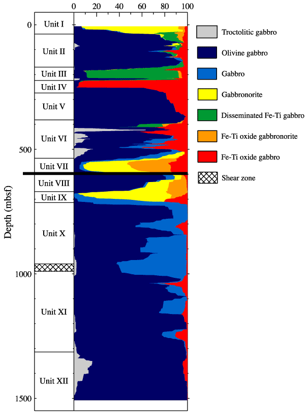
Figure F2. Schematic diagram showing the lithostratigraphy of Hole 735B as a function of depth. The black line at 600 mbsf indicates the approximate location of current hole obstruction and marks the bottom depth of the available logging data. Figure modified from Dick, Natland, Miller, et al. (1999).