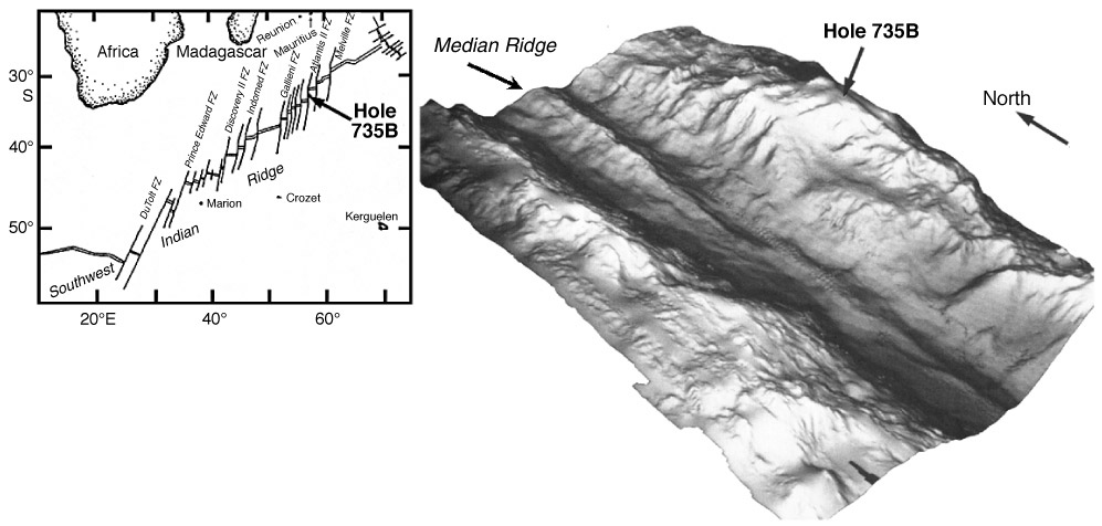
Figure F1. Location of Hole 735B on the Southwest Indian Ridge and an oblique shaded-relief image of a portion of the Atlantis II Fracture Zone transform valley, showing Atlantis Bank, where Hole 735B was drilled. The relief image, from the frontispiece of the Leg 188 Scientific Results volume (Von Herzen, Robinson et al., 1991), is based on a multibeam survey carried out in 1986 (Dick et al., 1991b), and represents an area of ~4000 km2. Hole 735B is in 720 m of water, and the floor of the transform valley is ~6000 m deep. The initial targets for Leg 118 were on the Median Ridge in the transform valley. FZ = fracture zone.