![]()
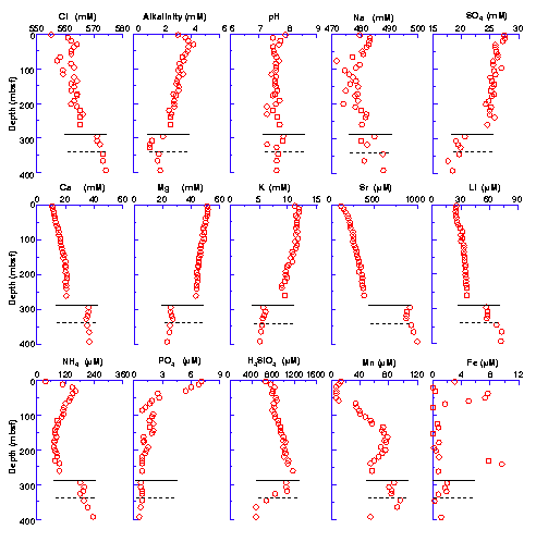
Figure F21. Interstitial water chemistry profiles vs. depth for chlorinity, alkalinity, pH, sodium, sulfate, calcium, magnesium, potassium, strontium, lithium, ammonium, phosphate, silica, manganese, and iron at Site 1090. Data are reported in Table T12, p. 94. Solid and dashed horizontal lines in each plot represent approximate locations of the chert layers at ~290 and 340 mbsf, respectively, in Hole 1090B.
![]()