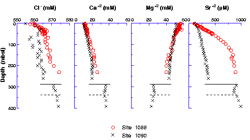
Figure F22. Comparison of profiles of interstitial water Cl-, Ca+2, Mg+2, and Sr+2 from Sites 1088 and 1090. Solid and dashed horizontal lines in each plot represent locations of the chert layers at ~290 and 340 mbsf, respectively, in Hole 1090B.