![]()
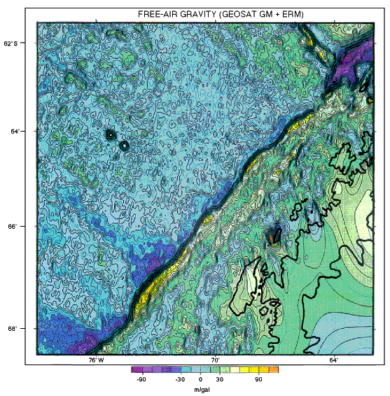
Figure F8. GEOSAT GM mission satellite-derived free-air gravity map of the Antarctic Peninsula and southeast Pacific. Progradational Lobes L1 through L4 at the peninsular shelf edge are prominent gravity highs. A lesser linear anomaly marks the mid-shelf high. On the continental rise, the larger hemipelagic drift mounds also form gravity highs because of their bathymetric expression (compare Figs. F5, F7, and F11).
![]()