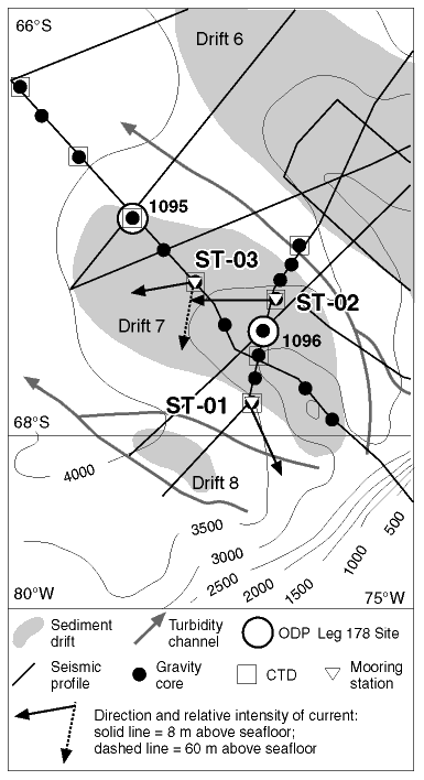
Figure F46. Location map of the moorings on Drift 7, indicating CTD stations, gravity cores, seismic profiles of the SEDANO program, and Leg 178 sites. Directions and relative intensities of mean currents are indicated by arrows.