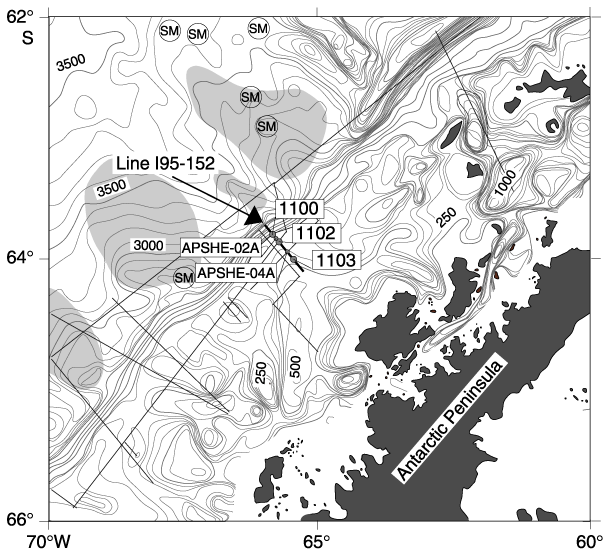
Figure F1. Location map of Leg 178 drill sites along the continental shelf transect. Sites originally selected as drilling targets are labeled as APSHE-01A (drilled as Site 1102), APSHE-02A, APSHE-03A (drilled as Site 1100), APSHE-04A, and APSHE-10A (drilled as Site 1103), according to the labeling in the drilling proposal. Only three of these targets were drilled during Leg 178, as shown in the figure (see also Figure F2). Bathymetry is after Rebesco et al. (1998). The location of Istituto Nazionale di Oceanografia e di Geofisica Sperimentale (OGS) multichannel seismic profiles is outlined by black straight lines. The shaded patches on the continental rise outline the inferred extent of sediment drifts.
![]()