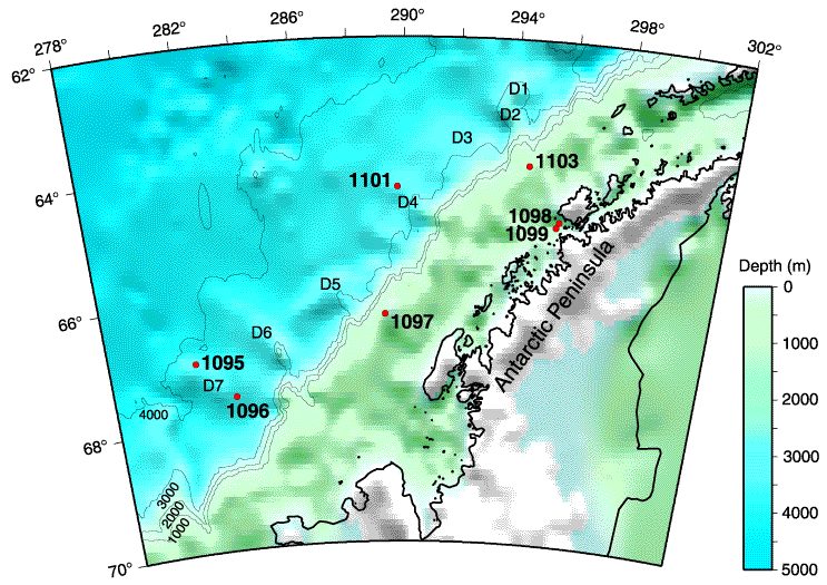
Figure F1.
Bathymetric map of the West Antarctic Peninsula area, Leg 178. Red dots = drill sites, D1-D7 = sediment drifts.