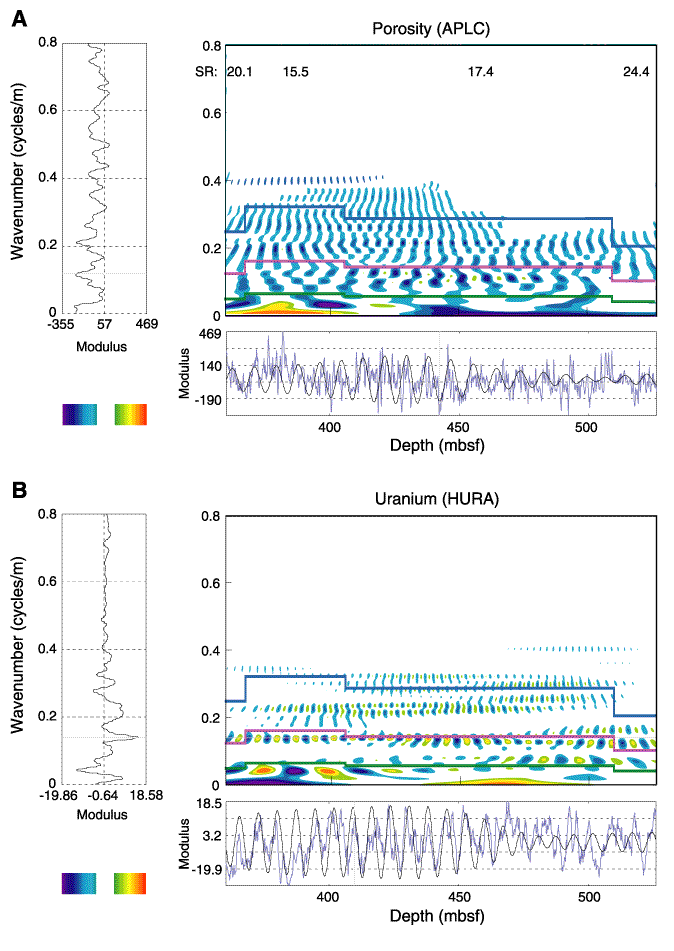
Figure F15.
Hole 1096C, lower section (from 360 to 525 mbsf). Spectral maps for (
A
) porosity and (
B
) uranium logs. The presentation is the same as Figure
F7
. SR = sedimentation rate.